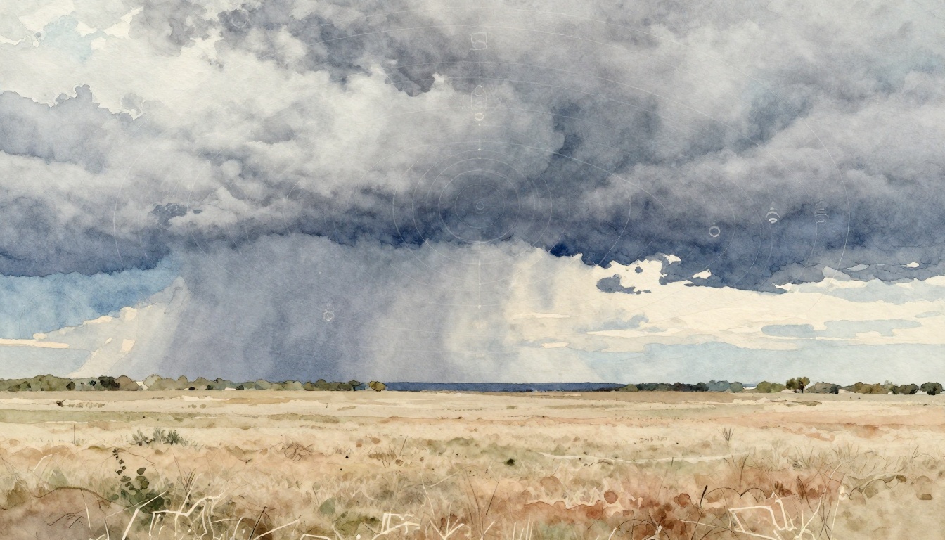
On March days in Texas, you can watch the sky change fast. In March 2026, multiple severe storm rounds moved across the region. Early weather forecasting helped many people decide when to stay put, when to travel, and when to take shelter.
Weather forecasting means using current atmosphere data plus computer models to estimate what will happen later. That simple idea matters because it affects safety, planning, and even household budgets. When forecasts are good, people can prepare before the first warning siren or sudden downpour.
In this guide, you’ll learn how forecasters turn radar, satellites, and observations into accurate weather predictions. You’ll also see which technologies speed up results, and why AI is now part of the forecasting workflow. Finally, you’ll connect forecasting to real outcomes, from storm safety to farm timing and day-to-day decisions.
The Simple Science Behind Predicting Tomorrow’s Weather
Weather forecasting works because the atmosphere behaves like a system with rules. Heat from the sun pushes air upward. That movement changes pressure. Meanwhile, moisture and wind help build storms. Add all of that together, and you get patterns that computers can simulate.
A useful way to think about forecasting is like testing a weather “what if.” Observations are the starting frame. Models run forward with physics. Then forecasters adjust details using real-world experience.
Most forecasting follows a clear, repeatable flow:
- Observe what the atmosphere is doing right now.
- Model what it might do next.
- Review results so humans can catch issues and refine timing.
This is why weather predictions can improve hour by hour, even for fast-changing storms. Also, why forecasts sometimes disagree. Different models can start with slightly different assumptions, and the atmosphere can shift sooner than expected.
Gathering Clues from the Sky and Ground
Forecasting starts with data. Forecasters pull clues from different tools, because no single sensor sees everything.
Weather radar helps show rain rates, storm structure, and where storms might intensify. That matters for severe weather, especially when storms rotate. Satellites add a wider view too, tracking cloud height, moisture, and large-scale systems over oceans and land.
Balloons sound simple, but they’re powerful. Upper-air balloons measure temperature, humidity, and wind far above the ground. Those layers help models “understand” how storm-supporting winds will evolve.
Local stations and IoT sensors fill in gaps close to you. They measure things like rainfall, wind, and humidity. Over oceans, data can be thinner. That’s where data assimilation comes in. It blends observations into the model’s starting point so the simulation begins as close to reality as possible.
If you want a plain-language walkthrough of how forecasters use observations and analysis, the National Weather Service has a helpful tour: the forecast process using observations and analysis.
Visual idea: sketch a circle labeled “Atmosphere today” with arrows pointing to radar, satellite, balloons, and surface stations. Then show those arrows feeding into a second circle labeled “Model starting point.”
In short, this step is like building a map before you plan a trip. Without the map, even the best navigation app guesses.
Letting Computers Crunch the Numbers
After the observation step, computers do the heavy work. They solve big sets of equations that describe air motion, heat transfer, and moisture. In other words, they simulate the atmosphere as it moves forward in time.
Most forecasting systems rely on Numerical Weather Prediction (NWP). NWP models use physics and current data to predict future weather fields like wind, cloud growth, and precipitation. If you want a deeper look at how NWP fits into modern forecasting, see numerical weather prediction (NWP) at NOAA.
Different forecast methods help for different time windows:
- Persistence: If conditions stay stable, the forecast can “hold steady.”
- Trends: If weather is moving or changing in a known direction, forecasters can extend that pattern.
- Nowcasting: For near-term changes, tools like radar can guide the next few hours.
- NWP: For longer planning, models run forward with physics.
Here’s a quick way to compare what each method is best at.
| Forecast method | Typical use window | What it’s good at |
|---|---|---|
| Persistence | Minutes to short hours | Stable conditions |
| Trends | Short to mid-range | Moving weather features |
| Nowcasting | About 0 to 6 hours | Rapid storm changes |
| NWP | Longer ranges | Full atmosphere simulation |
The best results usually combine these approaches. Meanwhile, human experts interpret what models might miss, like local terrain effects or unusual storm behavior.
One practical point: models can be likelier to get timing right than intensity, or vice versa. That’s why confidence matters. Ensembles also help. An ensemble runs the model many times with small variations. Then forecasters judge which outcome is most likely.
If you’re wondering where the “human refinement” fits in, the National Weather Service also describes the overall workflow in plain terms: the National Weather Service forecast process.
2026 Tech Making Forecasts Smarter and Faster
In 2026, forecasting is faster than it used to be. It’s also more accurate in many situations. The biggest reason is improved computing and better ways to learn from model output.
AI and machine learning now sit beside physics models instead of replacing them. This matters because weather has patterns humans can spot, but computers can’t always detect quickly. AI can find relationships between many inputs and outcomes.
Another shift is better model resolution. Higher detail helps capture how winds and storm cells behave near coastlines, valleys, and urban areas. Also, faster updates mean forecasters can revise warnings sooner.
In the U.S., you’ll often notice the difference when severe weather approaches. Forecast websites and local offices can update hourly. That helps people act before the worst timing.
AI Joins the Forecasting Team
AI is making forecasts more accurate and faster by finding patterns across large data sets. For example, The Weather Company reports it’s now nearly 4 times more likely to be the most accurate forecaster than its closest competitor. It also reports major gains for longer forecasts, around 14 days into the future.
Speed is a big deal. Traditional methods require computers to run physics equations, which can take a long time. AI approaches can generate results up to 100,000 times faster in some setups, according to recent reporting. NOAA has also confirmed an AI-based system that can complete a 16-day forecast in about 40 minutes, using a tiny fraction of the computing power needed by older methods.
AI models can also compare well against strong physics baselines. Google DeepMind’s GraphCast reportedly outperformed a traditional European physics-based model on 90% of tests. Meanwhile, an AI system developed with the European center showed improvements on many key measurements, sometimes as much as 20%, and it can project hurricane tracks about 12 hours further than other models.
Still, the atmosphere isn’t a set of simple rules. That’s why humans remain part of the process. Even with AI, meteorologists review the output and use knowledge of real-world storm patterns.
A great way to see how the workflow comes together is to explore a NWS “forecasting the future” tour: forecasting the future from NWS.
Also, forecasts in 2026 are influenced by bigger ocean signals. When La Niña fades and El Niño begins, the jet stream can shift. That changes storm tracks and seasonal rainfall patterns. Recent outlooks suggest La Niña is ending soon, with a move toward neutral conditions in the next one to two months. Then El Niño has been projected for June to August 2026, with a chance it could become a “super” event later in the year.
For the U.S., that kind of shift can influence whether parts of the country expect more clouds and rain, or how winter storm risks may change. The key point is this, forecasting is better when multiple models agree, and when ocean signals match the pattern.
How Weather Forecasts Keep Us Safe and Thriving
Weather forecasts don’t just predict weather. They protect decisions. That includes when to drive, when to farm, when to board a flight, and when to close a school.
In severe storm season, the value is plain. Warnings reduce harm by giving people time. When warnings are accurate, communities can respond without waiting for damage to start.
In March 2026, Texas saw several severe weather outbreaks. Reports show 161 preliminary tornado reports for the month, about 330 severe hail reports of one inch or larger, and roughly 1,272 wind damage reports. Forecasts early in the month generally pointed to damaging winds and large hail as major threats. That aligned with what happened, with storm rounds moving across the region over several days.
It’s also useful to compare years. March 2025 was more tornado-active, with around 300 tornado reports and higher hail and wind totals. That comparison shows why you can’t treat each spring as “the same.” Forecasting helps adjust expectations in real time.
Protecting Lives During Storms and Disasters
For tornadoes, hail, and damaging winds, timing matters. A warning sent too late leaves no action window. A warning sent too early can cause confusion. So meteorologists work hard to balance coverage with confidence.
Forecasts help in a few key ways:
- They give lead time for people to find shelter.
- They guide emergency managers on where risk is highest.
- They support safer decisions for schools, hospitals, and transit.
Meanwhile, severe storms also affect power grids, road access, and communications. In the short term, that means fewer injuries from falling debris. Over time, it means faster recovery because response teams can stage resources based on likely storm timing.
Global weather extremes also show why forecasting matters beyond one town. Heat, floods, and storms keep moving across borders. Better prediction means better planning for disaster response and long-range recovery.
One warning takeaway stays the same. If a forecast says storms are likely and your area sits in the risk zone, don’t wait for proof. Weather can change before radar updates fully catch up.
Powering Farms, Businesses, and Your Plans
Forecasts affect your day even when you’re not thinking about them. If rain is likely, you may delay outdoor work. If temperatures swing, you adjust schedules and clothing. If storms hit later in the day, you shift events.
For agriculture, weather forecasting is money. Planting timing depends on soil moisture, frost risk, and rain windows. Farmers need to plan around both heavy rain and dry stretches. Even a few days can change how well seeds germinate or how well crops recover.
For businesses, forecasts guide choices like delivery timing, staffing plans, and event permits. A company doesn’t want to cancel an event at the last minute. But it also can’t ignore forecast risks. Forecasting helps businesses manage uncertainty instead of guessing.
And for the broader economy, better forecasting can reduce waste. Accurate predictions help reduce avoidable losses from storm damage and crop failure. They also help public systems run better, because the forecast informs when to open shelters, when to stage crews, and when to issue travel advisories.
In 2026, ocean-driven outlooks also shape planning. With La Niña fading and El Niño expectations growing, forecasts can steer seasonal strategies. Some regions may see altered rainfall patterns. Others may see shifts in temperature. That matters for irrigation planning, water storage decisions, and winter prep.
Even if you only check weather once a day, that habit connects to the bigger picture. Forecasting improves as the data stream improves. So checking forecasts is also a vote for smarter information use.
Conclusion
Weather forecasting turns today’s atmosphere into tomorrow’s best estimate. It works because it combines observations, computer models, and expert review. Then AI, better data, and faster computing make updates more timely and often more accurate.
The real payoff shows up in daily life, from avoiding storm risk to timing farm work and business decisions. In March 2026, Texas storms proved how lead time can match the threats people actually faced. Forecasts didn’t remove risk, but they helped people prepare.
Keep checking forecasts before you make plans, especially in storm season. And when you see better warning coverage in your area, that’s the system doing its job. What would change for you if you acted on warnings a few hours earlier this year?