A picnic can turn from sunny to stormy in a blink. One minute you’re planning to grill, the next you’re hunting a towel for the rain. These are sudden weather changes, quick swings in temperature, wind, clouds, or storms that show up in hours or a couple days.
You might notice it most during spring and fall. But it can happen any time. When you understand the cause, the chaos feels less random. You can also make safer choices for driving, outdoor time, and travel.
So why does the sky flip so fast? In most cases, it comes down to a few big drivers: clashing air masses, shifts in the jet stream and polar vortex, and ocean conditions that feed storms. Climate change can then push the whole system toward more extreme swings.
Let’s break down what’s really happening when the weather suddenly switches gears.
Why Clashing Air Masses Spark Those Quick Weather Flips
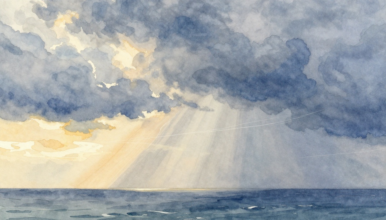
Weather changes fast when different air masses meet. An air mass is a big body of air with its own temperature and moisture. When a warm, moist air mass runs into cooler or drier air, the atmosphere can become unstable.
Think of it like mixing hot and cold water in the same cup. The boundary between them is where you often get strong movement, rising air, and clouds. That boundary is called a front.
A fast change often comes from a cold front. Cold, dense air pushes underneath warmer air. This forces the warm air up quickly. As it rises, the air cools, water condenses, and storms can fire off. You may see heavy rain, hail, sudden wind gusts, and a sharp temperature drop soon after.
Warm fronts behave differently. Warm air usually slides up and over cooler air. Because the lift is slower, the sky often turns gray before rain starts. You might get steady rain or drizzle, then a gradual clearing and warmer temperatures later.
If you want a quick mental picture of how fronts work, this guide to cold front weather patterns is a helpful starting point.
Also, remember that sudden shifts do not always come from fronts alone. But fronts are one of the most common reasons your forecast can change quickly. For a broader look at the atmosphere’s “why now” factors, see the science behind sudden weather changes.
Here’s a simple side-by-side view of what you tend to notice:
| Front type | Temperature trend | Sky and rain | Typical timing |
|---|---|---|---|
| Cold front | Drops quickly | Showers or thunderstorms; gusty winds | Often within hours |
| Warm front | Rises gradually | Cloud layers, steady rain or drizzle | Often over a day |
Cold Fronts: The Storm Starters
Cold fronts often show up after a warm day. You get sunshine or mild temperatures, then wind changes and the sky turns thick. As the cold air wedges in, the warm air lifts fast.
That fast lift matters. It creates strong cloud growth, often starting with puffy clouds. Then you may see heavier rain bursts. In some cases, hail forms as strong updrafts keep water droplets suspended. Severe thunderstorms are possible too, especially if wind shear helps storms rotate.
One clue is the wind direction shift. Before the front, winds might blow from the south or southeast. After the front arrives, winds often turn more westerly or northwesterly. You can also feel the air turn crisp soon after.
Here’s how that looks in real life. In early March, some parts of the Midwest saw a quick swing, near 70s Fahrenheit followed by snow the next morning. That kind of “warm then cold” jump often points to a fast-moving system, with colder air arriving by a front.
During the same season, another reminder is how quickly storms can ramp up. In March 2026, central and eastern areas saw severe storm outbreaks with large hail and tornado reports across multiple days. When a cold front organizes storms, the impacts can stack fast.
A cold front can change your plans in hours because it forces warm air upward very quickly.
After the front passes, you often get clearing skies. The air mass behind it tends to be drier and cooler. So, even if the morning looked like chaos, afternoon can feel calmer.
Warm Fronts: The Sneaky Warm-Ups
Warm fronts can feel less dramatic at first. Instead of a sudden plunge, you usually see a slow shift. Warm, moist air moves in over cooler air. Because warm air is less dense, it rises more gently.
That means the sky often changes in layers. You may notice high, thin clouds first, then thicker layers as the warm front gets closer. Rain tends to show up as steady precipitation. You might get misty drizzle, light rain, or longer periods of gray skies.
Temperature usually rises gradually. The change can still feel “sudden” if you’re used to clear weather. But the atmosphere doesn’t always drop or swing as violently as with a cold front.
One reason warm fronts matter for everyday life is timing. People often expect the rain to start right away. Instead, it can creep in over hours. That can mess with commute plans and outdoor events.
Warm fronts also connect to the “back and forth” mood in spring. One day you might experience fog or damp roads. The next day, a cold front may follow and clear things out quickly.
And, if you’re tracking the weather for travel, it helps to know that warm fronts can be broad. So, even if storms are not in the forecast, cloud cover and rain bands can still slow trips.
Jet Streams and Polar Vortex: Steering Weather’s Wild Ride
If fronts are the on-off switches near the ground, jet streams are the big steering wheels above. A jet stream is a band of fast winds in the upper atmosphere. It helps guide weather systems, like storms and air masses, across the country.
When the jet stream stays smooth, weather can move along more steadily. When it dips or loops, it can bring unusual air south or unusual warmth north. That’s when people notice sudden cold snaps or quick heat surges.
A simple analogy helps. Imagine a garden hose. If it bends gently, water flows in a steady stream. If the hose kinks, the pressure and spray direction change fast. The jet stream works a bit like that hose kink at high altitude.
In recent March conditions, that steering role stands out. Some areas saw hot spells early, then a rapid pull of colder air. When high-altitude winds shift, it can change what kind of air your region receives, even if the surface looked calm the day before.
This is also where the polar vortex enters the story. The polar vortex is a large circulation of cold air around the Arctic. It can stay tight and stable. When it weakens, cold air can spill farther south.
For a current look at how stratospheric warming can disrupt polar circulation, see polar vortex disrupted by sudden stratospheric warming.
How Jet Stream Shifts Deliver Surprise Cold or Heat
Jet stream meanders often come from changes in the upper-air flow patterns. When a jet stream dips farther south, it can pull Arctic air down. That can create quick temperature drops, sometimes with wind and even snow in late winter or early spring.
When the jet stream forms a ridge, it can allow warmer air to surge north. This can produce heat domes, where temperatures stay high for days. Then, when the ridge breaks, the weather can flip back.
This “flip” is what makes jet stream changes feel personal. You might not see the air turning cooler on satellite images. But you feel it in your thermometer and your sky.
In mid-March 2026, a major heatwave in the western US broke daily high-temperature records. Then, as the steering pattern changed, the risk of sudden shifts rose. That roller coaster is not random. It often tracks back to how the upper winds redirect air masses.
Polar Vortex Breakdowns Unleashing Chaos
A weakened polar vortex can act like a broken fence. Cold air escapes more easily. Sometimes it splits, sometimes it stretches. Either way, the result can be more frequent extremes, not just one big cold outbreak.
Polar vortex changes can also interact with storm tracks. So, you might get not only colder temperatures, but also more storm energy feeding the same region.
Climate science connects these patterns to the broader warming of the planet. While polar vortex behavior is complex, changes in temperature contrasts can influence upper-atmosphere circulation. In plain terms, the system can get less stable.
That can mean bigger swings between warm and cold seasons. It can also increase the chance that people see unusual weather in places that usually get more moderate conditions.
Oceans Fueling Fast Weather Surges from Afar
Oceans don’t only affect coastal weather. They shape the whole moisture supply that storms draw from. Warm sea surface temperatures can increase evaporation. That adds water vapor to the air. More moisture can mean stronger rain and higher storm intensity.
But cold ocean currents can cool the air above them, which supports fog and chills. Coastal breezes also form from land and sea temperature differences. In addition, oceans influence larger climate patterns that affect wind and storm pathways.
So, when a storm forms inland, it may still have “roots” over water. The air that ends up over your neighborhood can start as warm, moist air that traveled far.
For a clear explanation of how the ocean affects weather on land, check how the ocean affects climate and weather on land. It covers how the ocean stores heat and moves moisture around the globe.
A coastal example makes it real. Hurricanes and other tropical storms often gain strength over warm ocean water. If sea temperatures are high, storms can organize and intensify more quickly. That can shift from “watch it” to “move now,” even when the forecast sounded stable earlier.
So, oceans are not the only trigger. Yet they can make a system more intense once it starts.
Climate Change Cranking Up Sudden Weather Drama
Climate change does not mean every storm is caused by warming. However, it can increase the odds of certain kinds of extremes. When the atmosphere warms, it can hold more water vapor. That can translate into heavier downpours when storms do hit.
Warmer air also raises the baseline. Then, when cold air arrives, you can get more dramatic contrast. That can make temperature swings feel sharper, especially during seasons when the jet stream shifts.
There’s also new research showing warming isn’t just steady. It can accelerate in parts of the record. Recent reporting on global temperature trends points to a faster long-term warming pace since around the mid-2010s. See scientists detect a sudden acceleration in global warming for one example of that kind of analysis.
These shifts matter for real events. In March 2026, the US saw both intense heat and sharp cold swings. Some places experienced early heat, then later the weather tightened into stormier patterns. In the background, more moisture and warmer baselines can push storms toward stronger rain rates and higher flood risk.
Flash droughts also fit into the story. If you get hot, dry weather after wet conditions, plants and soil can dry out quickly. The swing can feel like the weather forgot the season.
A well-known example category is “heat to snow” in mountainous regions. In 2020, parts of the Rockies saw warm spells flip to wintry conditions within a short window. This kind of dramatic switch often reflects fast changes in upper-air flow. Climate change can affect the background conditions that decide whether moisture turns into rain, snow, or something mixed.
In farming, the stakes are high. Sudden heat can stress crops. A sudden storm can wash away topsoil or delay planting. For travelers, the risk is simpler, but still serious, sudden hail or high winds can make drives and flights rough.
The hopeful part is awareness. When people understand why the sky changes, they check forecasts more often and plan with a little more flexibility.
Staying Ready When Conditions Flip Fast
Now that you know the drivers, you can treat sudden weather changes like a pattern, not a surprise attack. Start with the forecast, then watch for the signals. If the forecast mentions a front, pay attention to wind shifts and timing. If it points to upper-air changes, expect more “odd for the season” swings.
A smart approach is simple:
- Check hourly forecasts when storms are near.
- Look for wind shift notes in front-related systems.
- Have a rain plan even if skies look mostly clear.
- Adjust outdoor schedules when temperatures could drop quickly.
Also, consider your past experiences. If your area often flips after a certain type of weather setup, trust that pattern. You’ll notice it sooner next time.
Above all, remember the big picture. Sudden weather changes usually happen because air masses clash, jet streams steer them, oceans add moisture, and climate change can raise the odds of extremes. When you can name the “why,” you can also prepare with more confidence.
What kind of sudden weather change have you seen in your area, heat turning to storms, or calm skies turning windy? Share it, then compare notes with what the forecasts said.