Last March, a lot of people in the Midwest checked their weather apps before work. Most saw “light snow” or “clearing.” Then the snow wall hit, hard and fast.
That kind of miss feels personal. Yet it’s not because forecasters “got it wrong.” It’s because some places set up tougher weather forecasting difficulties than others.
If you live near big mountains, far from the ocean, or in higher latitudes, you often deal with faster swings and fewer observations. Add east-west differences across continents, plus a warming world, and the forecast can lose grip.
So why are some regions harder to predict weather in? The answer comes down to geography, continent layout, climate change pressures, and the hard math limits of forecasting.
Geography’s Role in Weather Prediction Headaches
Weather forecasts depend on a simple idea. Start with good observations, then run a model forward in time.
The problem is that geography changes the rules of the game. It reshapes how air moves, where rain forms, and how storms grow. In other words, it decides how “readable” the atmosphere is.
Oceans Keep Things Steady, Inland Spots Don’t
Oceans act like a calming blanket. Water heats and cools slower than land. Because of that, coastal air tends to stay closer to “average” for longer stretches.
Step inland, and the atmosphere gets jumpier. Land surfaces heat up faster in the day. At night, they cool down fast. As a result, air pressure gradients and wind patterns can flip more quickly.
That matters because numerical models need stable patterns to forecast smoothly. When the surface keeps changing, the model has more ways to drift.
This shows up often across the US Midwest, where cold fronts and storm tracks can shift with little warning. If you look at post-storm evaluations, forecast errors tend to spike around exact storm timing and track, not around the broad idea that “something” is coming.
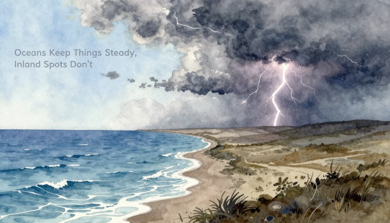
You can picture it like this: an ocean helps smooth the story. Inland terrain breaks it into chapters you didn’t expect.
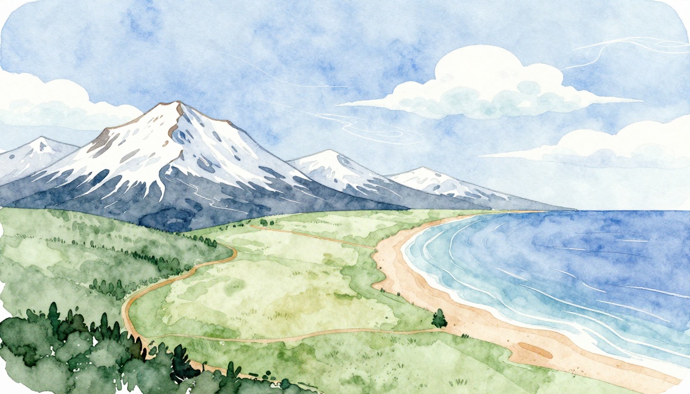
Mountains: Nature’s Weather Blockers
Mountains don’t just change scenery. They force the atmosphere to behave differently across short distances.
When moist air hits a mountain range, it rises. As it rises, it cools, and moisture often condenses into clouds and rain. That process is called orographic lift. Then the other side can end up drier, because the air lost much of its moisture.
You can see why this creates chaos for forecasts. A storm that depends on moisture and lift can intensify on one slope, then weaken just tens or hundreds of miles away.
If you want a clear explainer of the mechanics, see Weather.com’s “Weather Words” on orographic lift. For a broader scientific view of how terrain affects larger air circulation, npj Climate and Atmospheric Science on impacts of orography.
In northern Europe, ranges like the Kjølen (Kjolen) can create a windward wet side and a leeward dry side. Meanwhile, local upslope and downslope winds can push conditions around fast. The forecast may nail the big picture, but the details can still surprise you.
Polar Data Gaps Leave Forecasters Blind
High latitudes come with a different kind of problem. The atmosphere still moves and storms still form, but the data can be sparse.
Parts of Greenland and the Arctic often have fewer ground stations. Even satellite coverage can miss details like near-surface humidity, wind at very specific heights, or snow and ice effects on local moisture.
Then there’s ice loss itself, which shifts the background state the model relies on. When sea ice changes, the ocean-atmosphere exchanges can change too. That can affect patterns that show up far from the ice.
Recent research highlights how scientists are improving early warnings for Arctic sea ice loss using forecasting methods. For one example, ScienceDaily’s coverage of new Arctic sea ice forecasts points to the value of longer-ahead signals.
Even with better tools, polar forecasts often deal with uncertainty about the small inputs that steer storms later. So a forecast can look confident in a chart, but still wobble when it gets closer to your exact area.
Flatlands Fuel Fast-Changing Fronts
Plains can look simple on a map. In reality, they’re often where weather systems get loud and fast.
Open ground means storms can build and spread quickly once conditions line up. More importantly, fronts can act like moving boundaries. Where warm and cold air clash, thunderstorms and heavy rain can grow fast.
In the Northern Plains and upper Midwest US, this can lead to a familiar pattern: models get the general storm idea right, then struggle with the timing of precipitation bursts and the exact placement of the heaviest snow or rain.
Forecast verification after major storms often shows the same theme. The forecast isn’t always wrong about “storm exists,” but it can be off about where the worst impacts hit. For a concrete example of how accuracy can be assessed during a big US snow event, check ForecastWatch’s analysis of major U.S. snowstorm forecast accuracy.
Here’s a quick mental model. Flatlands don’t block storms. So storms roam. Then they choose your neighborhood when small differences in winds and temperature line up.
To summarize these geography effects, this table can help you connect “place” to “uncertainty.”
| Region type | What it does to the air | Why forecasts struggle |
|---|---|---|
| Coastal zones | Moderates heating and cooling | Smaller swings, easier model initialization |
| Inland plains | Speeds up heating, cooling, and wind shifts | Faster changes, less stability |
| Mountain regions | Forces lift and rain on one side | Strong local gradients, sharp rain-and-dry breaks |
| Polar areas | Limited observations near the surface | Models get less to chew on, more uncertainty later |
The bottom line here is straightforward. Geography doesn’t just change weather. It changes how well the atmosphere can be measured and modeled.
Why East Sides of Continents Outfox Predictions
If you’ve ever noticed that storms feel “meaner” on the east side of large landmasses, you’re not imagining it.
One reason is ocean influence and observation patterns. Over time, weather data collection and model behavior can make coastlines slightly more predictable than interior regions. Many forecasts also benefit when the air mass has traveled over the ocean for a while, rather than rapidly mixing over land.
There’s also the way major winds move. In the mid-latitudes, wind belts often carry weather systems west-to-east. As a result, the east side gets the mix first, then the details tumble out as systems interact with inland air and local moisture.
Weather.com’s meteorologists explain the idea in a practical way in “Ask A Met: Are Forecasts Better On The Coasts?”. Their answer is careful. It’s not a hard rule for every day. Still, they note that the differences are linked to observation and how forecasts get initialized.
Real storms show how this can play out. Nor’easters, coastal rain events, and sudden winter transitions often depend on sharp contrasts between colder air inland and warmer, moisture-laden air near the coast. Small timing errors can shift the highest impacts along the shoreline.
Think of it like a cooking process. West coasts can start with a more steady ingredient mix. East coasts often face a louder blend. Then, the final dish lands in a narrow time window.
So when the forecast looks uncertain, ask a simple question. Is your area sitting where two air masses collide, or where a storm needs to time its track just right?
Climate Change Makes Forecasts Feel Less Reliable
Climate change doesn’t remove forecasting skill on a fixed schedule. You still get days of useful warning, because satellites, radar, and models work.
However, climate change can make the weather story harder to interpret, even when the model math stays the same.
First, warming shifts the baseline. Warmer air holds more moisture. That can intensify downpours when storms form. It also changes when freezing levels rise and fall, which affects whether you get snow, sleet, or rain.
Second, warming changes the odds of certain patterns. If the atmosphere is more often in a “ready” state for heat waves or heavy rain, people notice more misses. Even a small shift in storm placement can mean huge differences in impact.
Third, Arctic change can influence mid-latitude patterns. When the Arctic warms and sea ice changes, the jet stream can become more variable. That can lead to stronger meanders and slower-moving systems. In plain terms, weather can linger or pop up in places it used to hit less often.
Also, some forecast difficulty comes from cycles that are not “caused by climate change,” but still shake seasonal expectations. ENSO is a big one. For a 2026 look at ENSO and possible global impacts, Severe Weather Europe’s El Niño Watch 2026 coverage summarizes how ENSO conditions could reshape rainfall and temperature patterns.
If you want an example of how model expectations can differ across regions, Climate Impact Company’s comparison of U.S. and Europe springtime rainfall forecasts highlights why even similar seasons can break differently.
So what’s the practical takeaway for you? Don’t treat “less reliable” as “useless.” Instead, expect bigger extremes and faster impact changes in a warming world. Then follow local warnings more closely, especially in high-impact seasons like spring storms or winter melt events.
And if you love the science side, keep an eye on improved modeling. Recent work in seasonal forecasting uses advanced machine learning methods to improve probabilistic outlooks, even though day-to-day weather still has its own limits.
The Butterfly Effect and Other Hard Limits
Some forecast limits aren’t about missing data. They’re built into the physics.
Weather is a chaotic system. That means tiny errors in starting conditions can grow over time. Meteorologists often describe this as the butterfly effect, inspired by the work of Edward Lorenz.
In practice, that chaos is why many forecasts fade in skill around the two-week mark. Even the best model starts from imperfect measurements. After enough time, those small differences can steer the forecast away from what actually happens.
So why do cities sometimes feel like “the forecast is cursed”? Two reasons.
First, cities create local quirks. Heat islands, building layouts, and local land cover can slightly alter wind and temperature. Models work on grid cells. Your street might not match that grid.
Second, rare events are hard to learn. A super specific storm setup might not appear often in the training data. Then the model has less evidence to guide it.

However, this doesn’t mean progress stops.
AI is improving parts of forecasting, especially at shorter ranges and for certain pattern recognition tasks. For one recent reporting perspective, see Bloomberg’s overview of how AI weather models are improving forecasts. The key point is not magic. It’s better pattern learning plus faster computations.
Researchers are also working on how to predict chaos and improve multi-variable forecasts. For example, RIT’s story about a new method for predicting chaos connects chaos theory to new ways of testing forecast behavior. Meanwhile, a scientific paper on improving multi-variable weather forecasting points to better handling of relationships between variables, not just one variable at a time (see Scientific Reports on multi-variable weather forecasting).
Still, even strong models can’t erase chaos. They can only reduce error at the start and handle relationships better.
Forecasts get best when models start with more accurate observations, and when they’re honest about uncertainty.
That’s the hopeful part. As sensors improve, especially in hard-to-measure places, uncertainty shrinks.
For you, the practical move is simple. In regions that already tend to be tough, treat the forecast as a “range,” not a promise. Then watch for updates from local meteorologists the day of the event.
Conclusion
Some places are harder to predict weather in because geography keeps changing the rules. Oceans steady the atmosphere, while inland plains and polar regions can amplify uncertainty. Mountains add sharp rain-and-dry contrasts over short distances, which makes fine details tough.
Then comes the continent angle. East sides often get more mixing and more sensitive timing as storms move west-to-east. On top of that, a warming world shifts moisture and the odds of extremes. So even when forecasts are skilled, impacts can still surprise people.
Finally, there’s the limit baked into nature: chaos. Small errors spread out over time, so confidence fades around the two-week window.
If you want to improve weather predictions in your life, pick the next update, not the first one. Check local warnings closer to the event, especially in hard-to-forecast regions. What’s the worst forecast fail you remember in your area? Share it in the comments, and help other readers spot the patterns that matter.